AMT performs studies and engineering development in steel, mining and chemical plants, starting from the data captured by the point cloud. We are based on our client’s needs, transforming the captured data into 3D or 2D models, which can be from basic to detailed.
Architecture and construction
We use high-precision point cloud information for the measurement of buildings and environments. We produce BIM models, generation of As-built documentation, 3D models, 2D floor plans, sections and elevations. The level detail will depend on the request and needs of our client.
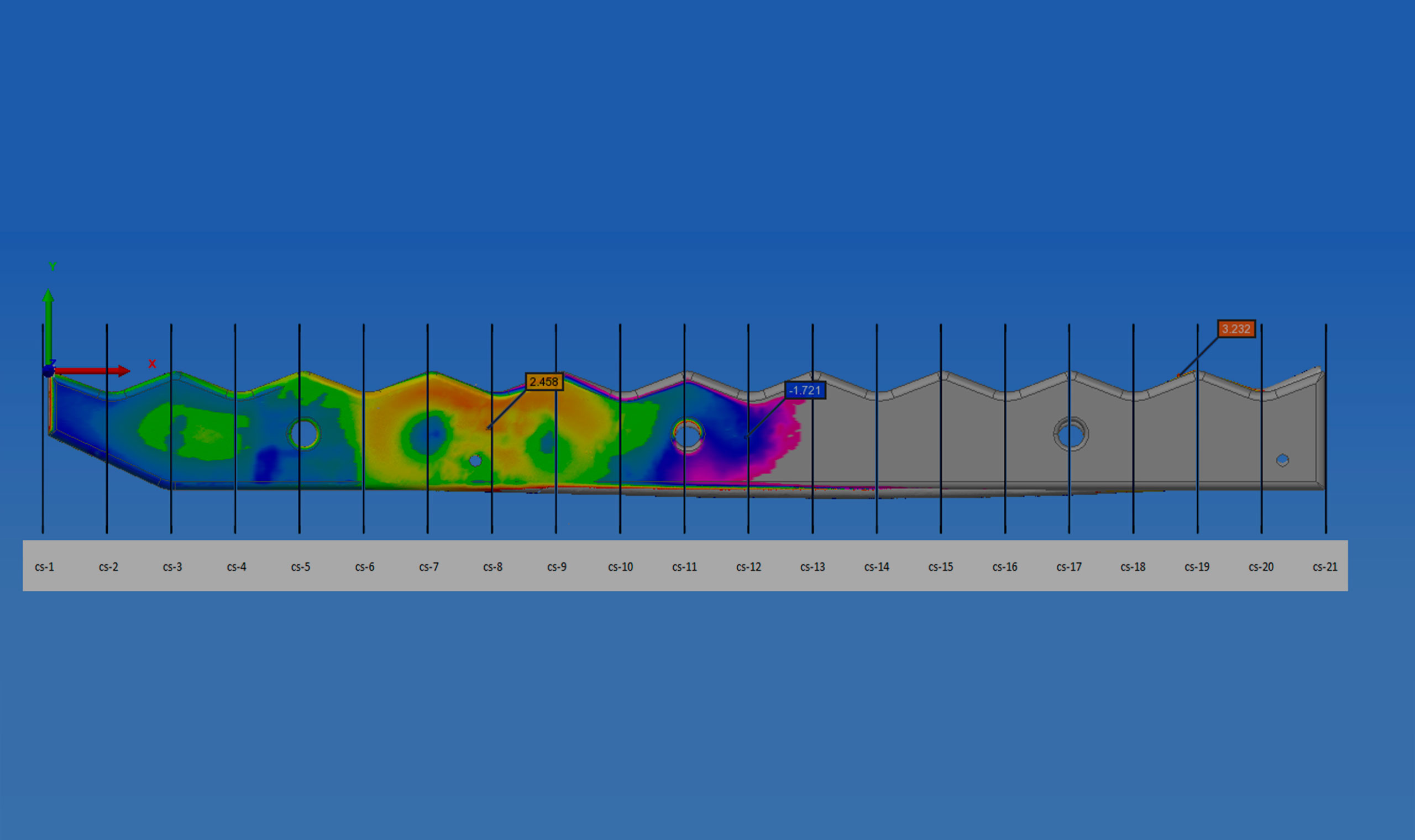
Reverse Engineering
We convert physical objects into digital elements and analyze each element to obtain accurate information and generate documentation as 3D CAD models and 2D documentation.
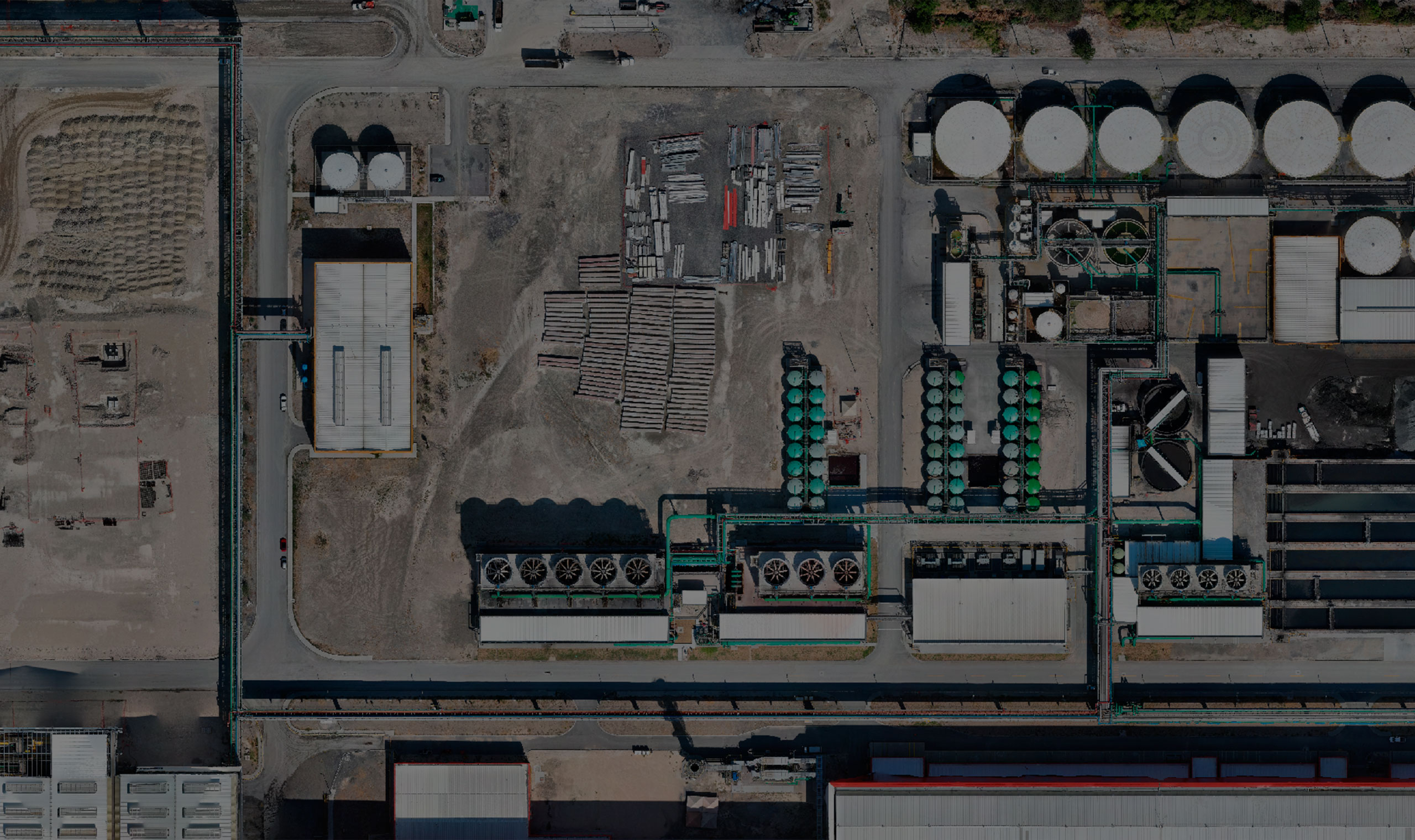
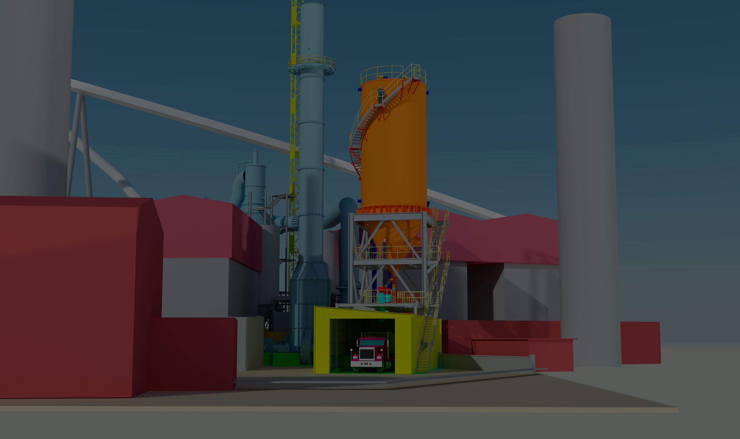
Digital Plant
We offer scanning services of environments, for the optimization of processes, security and training. We analyze the current state of the documentation, use of software and formats that our client requires.
About AMT
AMT (Arreglos y Montajes Técnicos), founded in 1996, is a multidisciplinary services company focused on 3D laser scanning for the design and development of basic and detailed engineering projects. Based in Mexico and the United States, we offer a variety of products and services related to point clouds, such as 2D documentation, 3D models and building information modeling (BIM).
We have experience in the industrial, energy, architectural, construction and more. Our human resource is formed by highly qualified engineers for the development of your project, we have mechanical, piping, electrical, civil and structural experts.
We work with technology like Faro, Autodesk and Solidworks. We are supported by more than 25 years of experience in the market, carrying by hand the values of ethics, responsibility, customer focus, quality and discipline.
For us the confidence of our clients is paramount, that is why we have wide standards of security and confidentiality.
For customers who require digital visualization of an object or environment for engineering analysis and development, we can generate it using 3D laser scanning.
We generate documentation such as floor plans, sections and elevetion, generating a variety of formats at different levels of detail as required by the project.